The Great Western Divide is a sub-range of the Sierra Nevada that separates the Kern, Kings, and Kaweah watersheds. The range is relatively remote (at least compared to other peaks and sub-ranges in the Sierra), and I had been wanting to visit it for some time.
My hiking partner Ben and I planned a six-day outing starting from Sequoia National Park. Our itinerary had us leaving from Twin Lakes trailhead near Lodgepole on July 3, and returning on the High Sierra Trail to Giant Forest Museum on July 9. Our goal was to climb a bunch of interesting peaks in the Divide while enjoying treks through the Tablelands and several high basins.
I arrived at Lodgepole campground the evening of July 2 with my friend Mia, after scarfing a huge (and far too cheesy) pizza at the Wuksachi Pizza Deck following our trail run in Jennie Lakes Wilderness. The night was clear and quite warm, so I stayed up later than usual (until nearly 10:30, wow) before bedding down. Ben arrived late in the night and slept in his car.
Day 1 – Silliman Scramble
Twin Lakes Trailhead > Tablelands
Mount Silliman (11,188′, Class 1)
We awoke around 7am, said goodbye to Mia after some breakfast and coffee, and managed to get everything packed and ready by 9:00. A quick trip to the Giant Forest Museum to retrieve our permit had us back at Lodgepole and starting up the Twin Lakes trail at 10:15am.
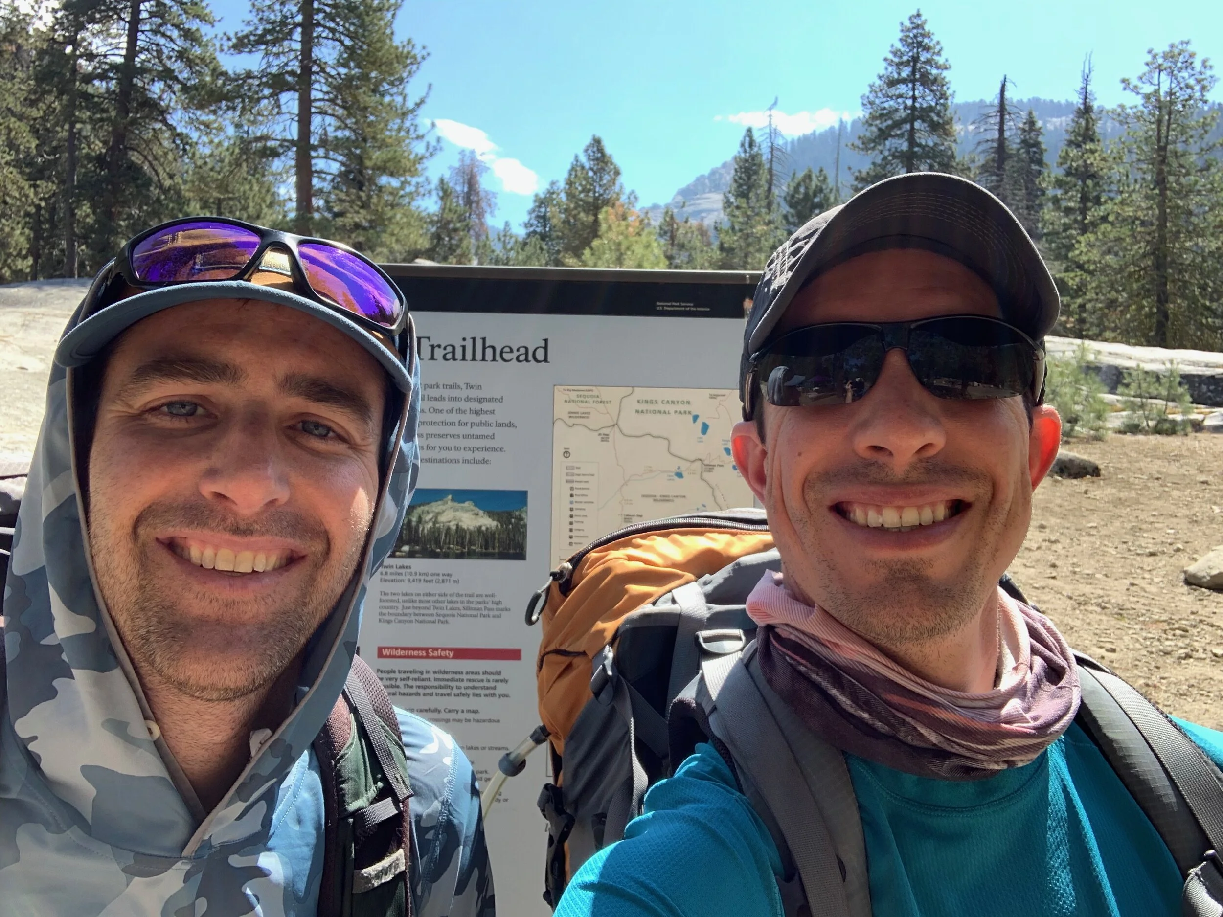
The obligatory trailhead selfie.
The initial climb up the Twin Lakes trail was straightforward and uneventful. After ~2 miles we reached a small creek crossing, our signal to turn northeast towards Mount Silliman and the Tablelands. A clear use-trail along the southern side of the creek was evidence of the popularity of this route. We followed the use-trail through riparian vegetation, climbing at points over granite slabs, before leaving the creek to head straight east to the base of a very large friction slab. Oddly we saw two half-empty backpacks lying in the middle of the use-trail, but no sign of the hikers themselves – our best guess was that they were climbers who were so excited to start clambering that they couldn’t be bothered to stow their packs. Or alternatively, that they were being pursued by a bear. A mystery that will remain unsolved I’m afraid.
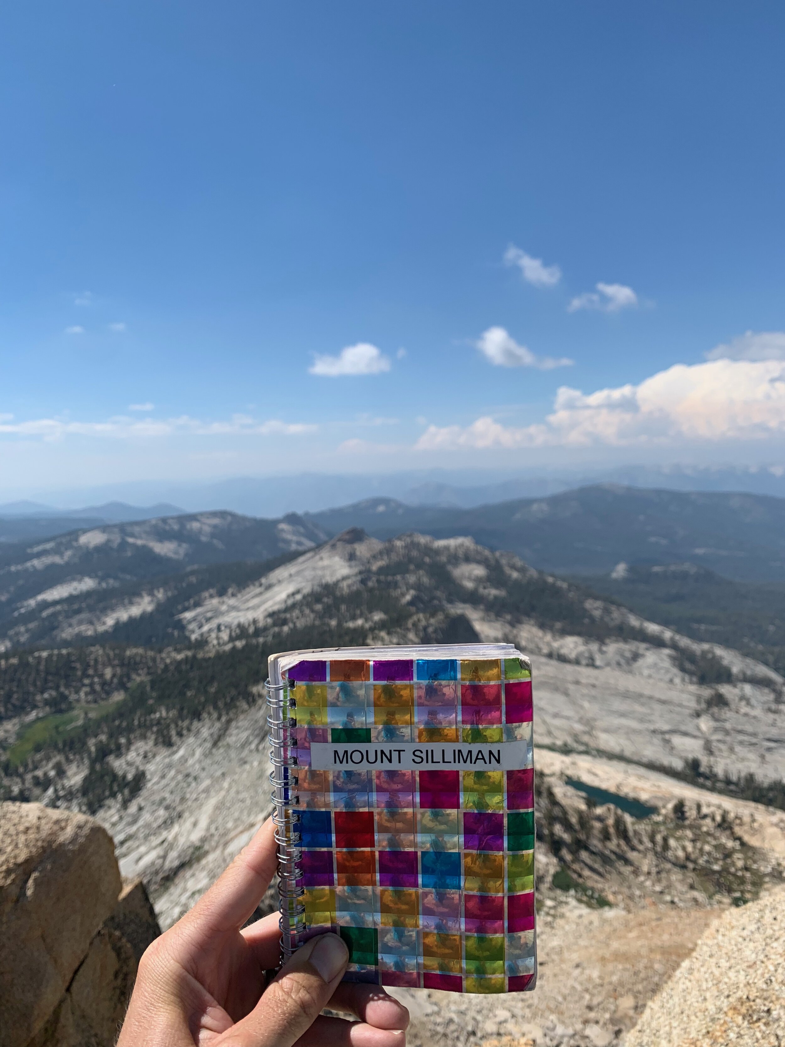
Silliman and the multicolored register.
In any event, we started up the (now quite steep) use-trail on a grassy ramp, before deciding to hike directly up the slab. The granite was sticky and free of small rocks, making it a simple but tiring ascent over ¾ of a mile. I stayed ahead of Ben and eventually topped out below some small cliffs, where I waited for Ben. Easy ramps and ledges through the cliffs led us to Silliman Lake, where a fortunate Jeffrey pine provided shade for lunch. We then proceeded northwest up similar terrain for less than ½ mile to a small tarn below Silliman Peak. Ben had decided to forgo the Silliman ascent, as he was still acclimatizing and low on sleep, so I left for a solo summit, claiming that I would be back in 45 minutes. I dropped my pack at the tarn and ascended an easy, grassy ramp to the ridge, following it to just below the summit, then up sand and solid rock. I quickly signed the register (which had an unusual rainbow-colored cover) and headed back down, this time losing elevation on the southeast face before turning southwest to regain the ridge and follow it down to the ramp. Total time: 49 minutes. Oh well.
Ben used this time to begin ascending our next goal: an unnamed pass southeast of the peak. I could barely make out his figure 2/3 of the way up, where it appeared he had followed a chute (more like a crack from a distance) that topped out at the pass. I followed a small creek the base of the chute, which revealed itself to be easy Class 2 with solid rocks and handholds. At a couple points I reached very short waterfall pitches, easily surmounted by briefly climbing out of the chute to the left. At the second pitch, I heard Ben yell to continue up the chute, and after following his instructions emerged at the pass. I took in the fine views of Silliman and the western slope (which I had only briefly looked at from Silliman Peak), as well as the Tablelands to the east. The Great Western Divide was visible but still small on the horizon.

View from the Tablelands into the foothills and Central Valley.
From the pass, we descended down a wide Class 2 chute for ~200′, before realizing that we could climb north to the face and traverse northeast, to avoid losing unnecessary elevation. I followed Ben as we hiked through Class 1 talus to a lightly sloping timberline forest south of the Kings-Kaweah Divide. At the other side of the forest, we encountered a steeper slope that we needed to descend to continue on the south side of the Divide. I initially chose a stupid route through bushy (and slippery) vegetation, before traversing north to easier grassy terrain. Once at the bottom, we agreed to take a direct line south of the Divide up to a tarn we identified on the map. Easy walking led us to the tarn by 5pm, which had ample potential campsites. A beautiful place to sleep for the night, with the added bonus of views all the way to the coast range.
Day 2 – Lots o’ Passes and a Failed Ascent
Tablelands > Glacier Lake
Big Bird Peak (11,620′, Class 1), Copper Mine Peak (12,316′, Class 1)
We decided to take it easy in the morning and awoke around 6:30, hitting the trail by 8am. I felt refreshed but tired early due to the heaviness of my pack – it’s really time to dump my 4 lb MSR Hubba tent for a tarp tent!

The final bit of talus before the summit of Big Bird Peak.
Our route across the Tablelands led us almost straight east, first over a small “pass” (really just a break in some short cliffs, leading to a flat plateau) and then easy walking for another two or so miles to Big Bird Peak. Our original route had us bypassing the peak and descending to Pterodactyl Pass to the southeast. But when presented with a Class 1 ascent – and a reported easy Class 2 descent down the northeast face to our destination – we couldn’t resist checking out the top. Sandy walking with a few Class 2 moves led us to the top, sans register, with views of the Great Western Divide coming clearly into focus.
We then descended ~200′ and then traversed east above Lonely Lake (which was to our south) and up easy Class 1 slabs and ledges to Horn Col, where more terrific views awaited. Luckily skies were clear with a few clouds, and temperatures remained mild – a perfect day to be out in the mountains. We descended ~100′ or so into Elizabeth Bowl and traversed to the southeast towards a nice shady spot in the talus, where we lunched on the usual peanut butter tortillas and salami.

View of Cloud Canyon to the north from the head of Elizabeth Bowl.
Continuing our Elizabeth Bowl traverse, we crossed over the Elizabeth Pass trail (which I actually missed seeing) and up-and-over a few ribs of the south face of Copper Mine ridge. We eventually reached a use-trail which appeared out of the blue, and led us up easy switchbacks to the entrance of the old mine. We peeked inside its dark confines and perused some assorted old junk set to the side – including a very old, rusted tin cup that appeared to be from the 19th century. A few more switchbacks and we gained the ridge, which we followed to Copper Mine Peak. The Great Western Divide appeared ever closer, with Black Kaweah to the southeast rising far higher than the surrounds. Fine views of Triple Divide Peak to the east, and Cloud Canyon to the south, enabled us plan our next moves.
We retraced our steps for 50′ or so just below the ridge before hopping up and over onto its north face. After descending some annoying Class 2 loose scree, we traversed east about ¾ of a mile to a tarn just below Lion Lake Pass, arriving around 3pm. Triple Divide Peak loomed large to the southeast, and we decided we had enough time in the day to attempt a summit. Secor notes multiple routes, with the east ridge from Lion Lake Pass categorized as Class 3. We decided on this route, dropped our packs, and headed up a wide Class 2 chute to a flat area on the south face, where we started our ascent to the east ridge. Climbing to the ridge was initially easy Class 3 on solid rock with good handholds, but upon gaining the ridge began to look a good deal sketchier, with some snow tongues blocking the easiest path. We studied the route intensely and figured the only way further was an exposed Class 3 scramble above the snow. My palms were getting sweaty looking at it. After a couple of minutes, Ben stated the obvious – that it was late in the day and the risk wasn’t worth it. I concurred and we turned around, picking our way down the face and chute back to our packs. Triple Divide would have to wait another day, via another route.

Camping at Glacier Lake.
After picking up our packs we traversed the bowl (following the footsteps of a solo hiker we saw previously) around and up to Glacier Lake, which sits below the steep south face of the peak. Tent site selection was iffy but we managed to carve out a couple of spaces. Too cold to swim, and with cooler winds blowing from the south, we cooked some dinner and called it a day.
Day 3 – Triple Divide, an Afternoon Swim, and the Mosquito Pit
Glacier Lake > Colby Lake
Triple Divide Peak (12,595′, Class 2-3)
The winds died down overnight and I slept blissfully, awaking refreshed and ready for another summit attempt. After a quick oatmeal breakfast, we threw on our daypacks and began the trek to Triple Divide Pass by 8:00. This route took us around the south side of the lake to a gentle talus slope below the pass, which gradually grew steep and loose before devolving into scree. There appeared to be two equally possible chutes to gain the ridge, and we chose the right-hand (west) chute since it was slightly closer to our destination. Some Class 2 scrambling on scree (luckily with a few solid handholds on the chute wall) led us to the top.

Perusing the register atop Triple Divide Peak.
The route here was, as Roper might put it, “exhilarating.” Trip reports note that one can stay to the south of the ridge for Class 2 scrambling, or on the crest for Class 3. We chose the latter as it appeared more straightforward and…well…fun. Exposure wasn’t too bad, but just enough to get the blood pumping in the morning. We stayed on the ridge for ½ mile until encountering a 10′ gendarme, which we bypassed to the north about 5′ below the ridge. Another ¼ mile of ridge walking led us to the summit pinnacle, which Ben ascended by stemming between two large boulders. I noticed an easier (though slightly more exposed) Class 3 route up some narrow broken ledges, and reached the summit at ~9:40. We took in excellent views of Lion Rock, Mount Spencer, and the Kaweah Range to the south and southeast, along with Cloud Canyon rolling out before us to the north.

Descending slabs into Cloud Canyon.
We retraced our steps back to the pass, though I let Ben get in front of me by a minute or so, and ended up missing our original chute. I decided just to descend the east chute, which proved to be similarly loose. After talus walking, we arrived back at our packs, resting only briefly to continue down Cloud Canyon. We scouted a Class 1 route on talus, then grass, down to the creek below, arriving around noon. The steep western face of the Whaleback loomed before us, with the “Jonah’s Joy” Class 3 route ascent soon appearing. We lunched in the shade – away from the ever-hotter sun – and decided an afternoon swim would be much more pleasant than another Class 3 climb. We continued on.
After another mile or so of cross-country travel, we were enveloped by marshy forest. It occurred to me that we had completely escaped the expected mosquito hordes on the trip so far, which I mentioned to Ben. Bad idea. Not a minute later, I noticed a mosquito on my arm, and was soon attacked by hundreds of bloodthirsty insects. Ben and I quickly threw off our packs and sprayed ourselves with repellant. Mosquitos would continue to haunt us for the next three days.

The ole swimmin’ hole.
Fortunately, after another ½ mile we emerged onto the Colby Lake trail, our main route for the next day or so. We turned southeast along Roaring River, swinging around the Whaleback (now to the west) and climbing gently towards Colby Lake and Pass. I had my eyes out for a swimming hole in the river mentioned by several trip reports (with original credit to Skurka for finding it). A beautiful pool below sunny granite cascades soon came into view. After assessing the mosquito situation, and finding it tolerable, we dumped the packs and jumped in. Refreshing!
Having skipped the Whaleback climb, neither Ben or I were in a hurry. We did some laundry and lounged next to the cascades on the gently sloping granite slab. A light wind kept the mosquitos at bay. Around 5pm, once our clothing had dried, we decided to hike the last ~2 miles to Colby Lake, arriving less than an hour later.
But oof – as nice as Colby Lake was, the mosquitos were ready for us. They terrorized us while we pitched tents, cooked dinner, and brushed our teeth. Both of us just pulled our bug nets over our faces and silently finished our meals and tasks. I couldn’t wait to get in the tent, managing to swat any stray mosquitos inside before dozing off. Death to mosquitos!
Day 4 – Peaks of the Divide
Colby Lake > Below Colby Pass via Lake 11,450
Midway Mountain (13,583′, Class 2), Centennial Peak (13,209′, Class 2)
That feeling when you wake up at first light, and the mosquitos have beat you to it. There must have been 20 of those suckers on the outside of the bug net at 6am. A reminder that there’s no escape until you (literally) get out of the woods!

Our old-timer friend enjoying the view from the Midway summit.
Our goal today was to climb several peaks in the Divide directly to our east. Two peaks, Midway and Milestone, were accessible from Lake 11,450, which – after a short, steep climb through the trees – was a straightforward and gentle cross-country ascent from the trail over grassy granite slabs. We arrived at the lake at ~9:20am, deciding to first attempt the easier Midway to the north. The route was an easily defined Class 2 climb up the western face. From the lake, we ascended more slabs to some cliffs below the face, which were pocked with multiple Class 2 lines up ~50′ to the gentle face of the mountain. From here it was simply a Class 1 sandy slog to the ridge, about ½ mile below the summit.
I emerged first on the ridge and was surprised to find an older fellow munching on a snack (he was surprised to see me too). Turns out we were both camped at Colby Lake, and he left early to summit Midway and fish in Lake 11,450. As Ben arrived, he told us that he was in his mid-seventies, and still tried to get into the mountains regularly. He owned a couple of mules (which we saw tied up at the lake) to haul his gear. We chatted to him for a while as he told us about his background in Bakersfield (including the time he saw Buck Owens at a buffet) and various ascents in the range.
As our conversation wrapped up, he then shared some wisdom that I thought about the rest of the trip – that he’s a “view-bagger” rather than a “peak-bagger.” Put differently, he’s more interested in seeing nice vistas than notching up challenging Class 3-4 ascents, or ticking off the SPS list. Some excellent advice that helps remind us why we’re out here.

The Midway-Milestone traverse sticks to the north (left) side of this ridge until reaching the summit block. We decided against it.
After departing, Ben and I quickly made it up easy Class 2 talus to the summit plateau, with expected views to the east across the Kern canyon all the way to the Sierra Crest. We were able to make out Whitney, Williamson, and Cirque Peak (all previous climbs), as well as Mt Russell, which I have yet to summit. Views to the northeast were clear as well, allowing us to catch glimpses of the Palisades and the distant peaks of Yosemite.
From the summit, reached around 11:30am, we had a decision to make. We could backtrack to the lake and decide whether to attempt a Class 3 summit of Milestone Peak, via a solid chute. Or we could (following a detailed trip report we downloaded) traverse below the ridge to the east and gain Milestone via a semi-exposed Class 3 climb up the summit block. Weighing the wisdom of our new older friend, we decided to simply descend and leave Milestone for another day. No sense overdoing it.
The descent on sand was quick and easy, making it past the lake and back to our packs on the Colby Pass trail by ~2pm. We climbed a ½ mile or so on the trail to a flatter, shady section where we lunched. Switchbacks then led us up the trail to the top of the pass by ~4pm.

On top of Centennial Peak, looking east towards Kern Canyon and the Sierra Crest.
Feeling good, we decided to climb along the ridge to Centennial Peak to the northeast, via an easy Class 1-2 route. We stayed to the south of the ridge until reaching a gap between two gendarmes, where we climbed over to the more gently sloping north side of the ridge. We then traversed around the taller pinnacle for ¼ mile before climbing up to gain the ridge. It was then easy Class 1 walking to the summit. Oddly the register was in a bear canister, which Ben opened and then struggled for about 15 minutes to close. Being a relatively remote peak – and not on the SPS list – the register was fairly empty, and we appeared to be the first visitors for the season.
An hour later we were back at the pass and our packs. We descended on the trail a mile or so to a flatter section of grassy slabs and lone pines. After a little searching, we found two flat spots for our tents, with enough light to wash up in the creek. Mosquitos were thankfully almost completely absent thanks to some light winds. I’ll take this landscape over the forested mosquito pit any day.
Day 5 – The Kaweah Range
Below Colby Pass > Nine Lakes Basin

The beautiful, but mosquito-infested, Kern-Kaweah River.
The whole trip has felt like we’ve been working up to this point – the point where we meet the Kaweah Range. Remote Black Kaweah has been looming over the Divide the entire trip. What will these famously loose peaks look like up close? Would they be worth a climb?
But first, we had to descend more than a thousand feet to the Kern-Kaweah River and the inevitable mosquitos that would greet us. I started feeling bites as soon as we entered a section of timber on the steep trail switchbacks. Time for the bug net and repellent. As we continued our descent, we passed a solo hiker heading up towards Colby Pass, and we exchanged pleasantries through the dark netting without lingering too long. Twenty minutes later and we arrived at our turnoff up the river at ~9am, which Ben fortunately announced after I’d walked several yards too far.

Looking down the Pants Pass chute.
The upper Kern-Kaweah is a beautiful place, with a burbling stream flowing through meadows ringed by pine and towered over by the peaks of the Divide. Unfortunately for us, it also hosted the worst mosquitos yet. We hiked briskly along the meadow’s edge. I was so tired of being bitten, I decided to place my poles in my pack and keep swatting my arms in what became a kind of pattern. We reached timberline after two or so miles of easy walking, along with a lovely breeze that blew most of the bugs away – hopefully for the last time!
From this point, our aim was to navigate an ascent through a rocky, sculpted landscape pocked by tarns, with the eventual goal of reaching Pants Pass (not to be confused with “Piss in Your Pants Pass” to the north – which appears easier until you look down sheer cliffs on its western side). We found grassy ramps and – eventually – shallow rocky slopes up through numerous tarns to the base of the bowl below the pass. There were two chutes: the pass was located up the northern, higher chute (the lower chute is impassable to the west). We ascended solid talus which grew increasingly loose, though not alarmingly so, until reaching the base of the chute.

Descending down the west side of Pants Pass. Our unpleasant scree traverse was to the left.
Ugh – loose chutes suck. But it was the only way over the top. And at least there were a few solid hand-holds on the side of the chute to the right. I began the ascent with Ben behind and to the left. Scree and sand slid under my feet, and I used all fours to climb. After ~20′, I found my rhythm with the hand-holds, making quick time until 15′ below the pass. Here, I chose to veer right onto more solid ledges topped with small rocks and sand. This proved easier, and after a final traverse back to the top of the chute, emerged on top at ~1pm. The pass was rated Class 2, though it the final stretch certainly seemed Class 3 to me!
A quick snack later, and we were on the descent. Our route down the west side also utilized a chute, but it seemed somewhat more shallow and solid overall, with hand-holds in the cliff to the left. At one point, the chute grew much looser, and Ben (who was in front) decided to traverse over a rib to another chute to our left. A good decision, as this adjacent couloir proved easy to pick our way down. Arriving at a steep and semi-loose talus slope, we made a fateful decision to traverse for several hundred yards to the south, to avoid losing too much elevation. The traverse was awful – hot, loose, and relentless – and took the better part of an hour. It was only when we reached a ridge and peered down to the south that we realized we needed to lose elevation anyways!

The lake below Mount Lawson (on the left) and Kaweah Queen (on the right). We didn’t feel like climbing 3+ hours of scree.
Alright, well. At least we were finally in Nine Lakes Basin, the base camp for Kaweah ascents. We dropped down to one of the lakes and followed its outlet east a few hundred feet, before turning south to head up and over into the next drainage. There, we managed to find a couple of overhanging cliffs offering the narrowest of shade for lunch. It was 2pm and we were tired. Would we climb any peaks?
Not wanting to decide yet, we figured we would drop our packs and climb to the uppermost lake in the basin, from where we could climb Mount Lawson or Kaweah Queen. After I stupidly led us up and over a rocky mound to the south of the drainage – when we could have just followed the stream around – we ascended ramps next to the stream to a first lake, and then steeper (but solid) talus to the second lake. A short 100′ walk from that inlet led us to the final, third lake.
We sat on a rock and gazed at Lawson Peak, the easier of the two ascents at Class 2. It looked like one very long, loose, hot slog up a scree slope – the entire way. Is this really how we wanted to spend our afternoon and evening?
It didn’t take long to decide that we didn’t. We’re “view baggers” after all. And it would be much nicer to make camp at the lowest lake and go for a swim instead!

Cooling off in Nine Lakes Basin.
Which is just what we did. We made our way back to our packs, followed the drainage down, and then easy slabs to the lowest lake, arriving at ~4pm. Great camping spots were everywhere. We pitched tents, shed layers, and jumped into the water off a giant rock. And after doing laundry, spent the rest of the day lying around. This is what I’m talking about.
We didn’t want to completely give up on peaks, though, and had been spying potential routes up Mount Stewart (part of the Divide, but not the Kaweahs) on our descent from the upper Nine Lakes. The old timer had mentioned Stewart as a potential climb, and – though we hadn’t studied its routes on paper – looked to be easily ascended from Kaweah Gap. Upon further inspection, we also saw a grassy ramp leading almost straight up to a short traverse to the face below the summit. We decided to attempt it the following morning.
Day 6 – A Cool Ascent, a Hot Slog
Nine Lakes Basin > Buck Creek
Mount Stewart (12,165′, Class 2)

Some fun Class 3 scrambling on Mount Stewart.
A great decision. The grassy ramp was a pleasure to hike, including a fun little Class 3 pitch through some giant boulders. Reaching the top of the ramp, the “traverse” was really just a straightforward Class 1 walk, and the talus of the east face was low-angle and solid. The only problem? I led us to the wrong summit!
Yep, that’s right. Both of us were eyeing a summit in our climb through the talus, and after arriving first, I searched all over for the register. A finally took out my phone to check our position in relation to the summit labeled on Gaia. What do you know – it was a few hundred feet to the north! We would have been there 10 minutes earlier had a checked the map properly. Oh well.
In any case, a short Class 2 scramble on the ridge led us to the actual summit by 9:15am, which we surmounted with a couple of Class 3 moves. We snacked and looked through the register for recognizable names. At least two entries mentioned that the other summit on the ridge is higher. So, I felt somewhat vindicated.
Views were spectacular in every direction. To the north, we could easily see Triple Divide Peak (climbed two days earlier) and make out peaks of the Divide. To the east was the imposing Kaweah crest. And to the south, the last remaining high peaks of the Sierras before they transformed into gentler terrain.

View from Mount Stewart towards the Kaweah Range to the east.
We made quick work of the descent, arriving at ~10:30am, and after collecting our packs cruised around the lake to the High Sierra Trail. This would be our route the whole way back to the front country. A few hundred feet of switchbacks and we were at Kaweah Gap, for one last look at the Kaweahs and the Big Arroyo spreading out below. We then began the long descent, admiring some lakes along the way, and stopping at one for lunch (and a swim for me) around 1pm.
The rest of the day can simply be characterized as a hot slog alongside the Middle Fork of the Kaweah. There were some nice points – a tunnel carved in the rock, a goose on an island in the lake, a beautiful view down the Valhalla waterfall – but it was just so hot. The trail stayed on the south slope of the river for hours, in punishing sun, and the trail eventually became forested and tedious.
After 8 or so miles we came to Bearpaw Meadow, a High Sierra camp that had been partially destroyed by heavy snow in 2019. No one was there and it appeared to be under construction. We filled our water bladders from the spigot and moved on.
~2 miles later – around 6pm – we arrived at a fantastic little canyon called Buck Creek. It was still 10 miles from the trailhead, and we hoped to make it a bit further, but the creek was calling our name. We found a couple of tent sites off the trail and made a beeline for a beautiful pool with its own “water feature.” It was so nice we even cooked dinner there. Good way to end the day.
Day 7 – A Sequoia Forest Finish
Buck Creek > General Sherman Tree Trailhead
I’m always eager to finish early on the final day. Not that I don’t like the mountains – I actually couldn’t wait to be back – but because I keep thinking about the massive burger I’m going to eat. So, it was easy to get up at 5:30am and on the trail at 6:30.
The last ten miles were uneventful – more pine forest, more slog – until finally reaching the front country and its sequoia grove. I’ll never get tired of walking through that majestic forest. We didn’t have a map – my phone died the day before, and we didn’t print off front country maps – so we just meandered through interlinked trails in the general direction of the big, famous Sherman Tree.
After checking out Tharp’s Log, and passing next to Crescent Meadow, we somehow ended up in an area I hadn’t seen before, which had far less hiker traffic. We reached a junction and continued on the trail, though I grew increasingly skeptical that it was leading towards our destination. Funny that we waited until a mile from the road to get lost!
After a hundred more feet, I told Ben we should turn around, and we found our way back to a more appropriate-looking trail, eventually confirming it was the correct route with a pair of hikers. Another mile and we were on paved ADA path, and then at the Sherman Tree. It’s a big boy. And, as we boarded the bus back to our cars, a good way to end the trip!
Of course…we had to have a couple beers (stowed under the seat of the car, and somehow remaining cool) next to the creek before leaving. And finish our last lunch. And go for a swim. And still head down the mountain by 1:30pm.